Bibtex
Segmentação Automática de Áreas Urbanas em Imagens de Sensoriamento Remoto
Anderson G. Marco and Adriana B. Bruno and Francisco A. Rodrigues and Luciano da F. Costa and Odemir M. Bruno
Learning and Nonlinear Models, 9:42-51, 2011
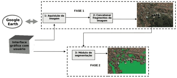
Computer vision methods applied in remote sensing images can bring important benefits to the field of urbanism. In this work, a computer framework to aid acquiring and analyzing remote sensing images from Google Earth R is presented. The proposed system connects to the Google Earth and extracts an image specified by the latitude and longitude coordinates. The image is automatically segmented into edified and non-edified regions. The segmentation process is carried out by the analysis of the image chromatic histogram. An experiment showing results from the segmentation of two São Paulo State’s towns are presented. The comparison of the histogram metrics and the color channels and its segmentation performance are discussed.